upper waypoint

Geological Outings Around the Bay: Point Pinole and the Hayward fault

Save ArticleSave Article
Failed to save article

Please try again

The Hayward fault separates tidal marsh and coastal grassland at Point Pinole Regional Park just north of Richmond. Photos by Andrew Alden.

The Hayward fault separates tidal marsh and coastal grassland at Point Pinole Regional Park just north of Richmond. Photos by Andrew Alden.

The Hayward fault threatens a lot of people and structures as it runs straight through the East Bay. But at its northern end, at Point Pinole Regional Shoreline, the fault can be walked and traced across open land with trees and grass. You can imagine the fault's biggest earthquake, a magnitude 7.5 event, doing little more than knocking you on your butt there.

Pinole Point is a gently rolling peninsula that points north-northwest into San Pablo Bay. It's underlain by 10-million-year-old gravelly sandstone of the Orinda Formation, but much more recent changes in sea level have left it draped in Pleistocene sediments, old soils and offshore peat beds. Still more recently the point was the home of an explosives manufacturer from 1881 to 1960. The East Bay Regional Park District bought the land in 1972, and today it's a nice place to stroll, run, ride, fish, picnic and geologize.

Much of the point is wooded, but the forest is exclusively eucalyptus, planted during the tree's heyday to help muffle the noise of explosives manufacturing and no doubt to provide shade. You can walk off the path easily when your curiosity beckons, and the light is beautiful.

You can see the green woods in this Google Earth view of the point, along with the mapped fault trace. Note that the park is named Point Pinole, but the point itself is Pinole Point.

Frame grab from the US Geological Survey's {link url=http://earthquake.usgs.gov/regional/nca/haywardfault/}Hayward Fault Tour{/link}.

But let's peek under the trees with the lidar digital elevation model. (I showed you lidar imagery of the San Gregorio fault a couple months ago.)

Data from {link url=http://opentopo.sdsc.edu/gridsphere/gridsphere?cid=otgoogleearth}OpenTopography{/link}.

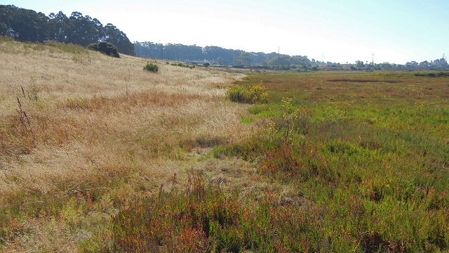
The fault crosses the railroad tracks at the south (right) edge, skirts the edge of the coastal marsh and traverses the west side of the point until it runs offshore into San Pablo Bay. (It's been traced most of the way across the bay, but it dies out as seismic motion steps eastward to the Rodgers Creek fault in the North Bay.) The maps at the park show a different line, which is incorrect.

Sponsored

The photo at the top of this post looks straight down the fault trace from the southern marshland toward the train tracks. The next photo below is looking north up the fault trace; on the lidar image it's where the fault trace, displaced west by a large landslide, returns to its straight track.

The grass was very tall here when I visited (goats will clean it up this winter), so the going was a bit hard. But it's quiet here off the trails, and I can recommend it as a place to meditate on the fault. The hollows along the break in slope all were much greener than the surrounding ground because faults tend to block the movement of groundwater. Very near here is where a trench was dug across the fault, one of several such scientific dissections made on the point in recent years. You can follow the fault north for a ways through the woods, but eventually it reaches the shore.

Landslides triggered by wave erosion have disturbed the western bluffs nearly everywhere on this part of the point, but where I was standing is as close as can be to where the fault meets the coast. As researcher Glenn Borchardt puts it, "the erosion produces seasonal changes in the exposure, so some lucky earth scientist or astute passerby may be the first to see the landward end of the fault." In the 1980s, a trench dug here in the surf zone revealed serpentinite on one side of the fault and mudstone on the other.

As you go farther north along the trail here, the bluffs grow quite high. The material they expose is coarse gravel, and the larger stones in the surf zone have an entertaining variety.

Near the point itself, the ground surface appears to be uplifted and tilted eastward. This is not unexpected around a major fault, but I have not seen anything documented about it. If you go out on the fishing pier at Pinole Point and look back, the tilt looks obvious.

Look all the way around while you're there; Pinole Point is uncommonly peaceful and remote while being in the center of a lot of North Bay landmarks.

None of the scenery at Point Pinole Park really shows the threat of the Hayward fault. But just south of the park is the Parchester Village neighborhood, a cookie-cutter of 1950-vintage suburbia planted right on the fault. There, just as clearly as in downtown Hayward, you can see the classic signs of aseismic creep slowly tearing apart the homes, lots and pavement.

Measurements show that the fault is moving around 5 millimeters a year there. Only our human encroachments reveal the ongoing action of the tectonic plates that brings the next big Hayward fault quake closer every day.

lower waypoint
next waypoint