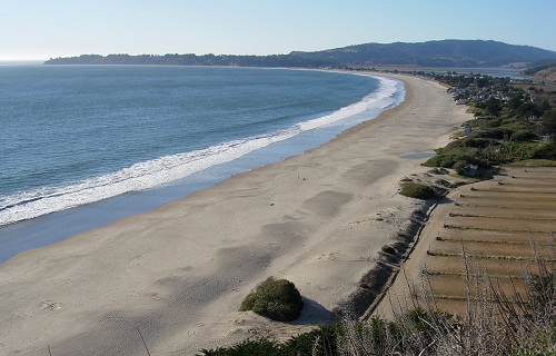
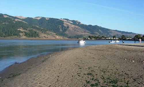
Stinson Beach is on Route 1 just north of San Francisco. You can drive there or take a bus, but either way what you see as you come in from the south is a lovely arc of sand. In the distance is the Point Reyes Peninsula with the low tableland of Bolinas on the left (a wave-cut platform) and the highlands of Point Reyes on the right. All of that land is on the Pacific plate and lies across the San Andreas fault. The fault runs just offshore, touching land in the center distance at the end of the beach and exiting the photo at upper right. Have a look at the geologic map.
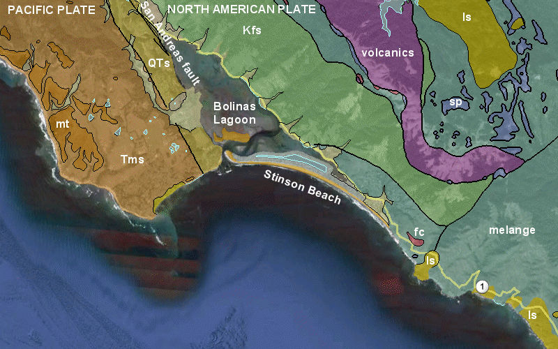
Click the map for a larger version. Abbreviations: mt, marine terrace, Tms, Tertiary (Miocene) sedimentary rocks; QTs, Pliocene-Pleistocene sedimentary rocks; Kfs, Franciscan sandstone; sp, serpentinite; fc, Franciscan chert; ls, landslide deposits. From Marin County section (KMZ file) of the USGS Bay Area Geologic Map.
Everything on the east side of the fault belongs to the Franciscan Complex, a big, sloppy geologic unit that includes bodies of sandstone, chert, shale, volcanic rocks and serpentinite. Parts of it are so mixed up that geologists have thrown up their hands and called it melange (which I featured in this post).
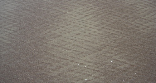
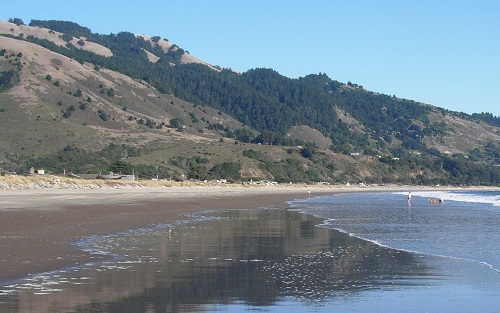
If you're drawn to that great plate boundary, walk to the north end of the beach. The waves hit the beach here at an angle, sweeping the sand into crosshatches.
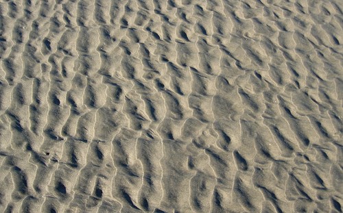
At the end of the beach is a tidal waterway leading to Bolinas Lagoon. There the repetitive wash of the tides builds symmetrical ripples like this.
You won't see the fault here unless it happens to rupture while you're visiting, which is extremely unlikely. But if that happens, take pictures because the waves will swiftly erase the evidence. The lagoon is a feeding ground for all sorts of seabirds as well as the town's sheltered anchorage.
As you head south back down the beach, notice the terrace at the base of the hills, where many residences in the town of Stinson Beach sit. This is probably the same type of wave-cut platform that appears up and down the California coast (like Pebble Beach).
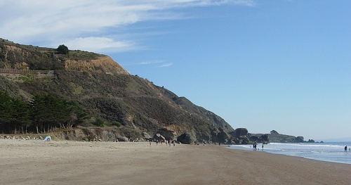
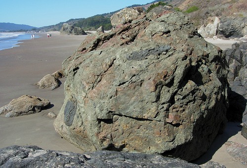
The beach's south end is a pile of boulders that have eroded from the geological plum-pudding of the Franciscan melange. The distant peninsula is the toe of an ancient landslide, one of many in this shaken-and-stirred area.
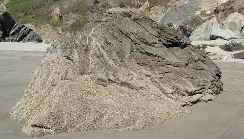
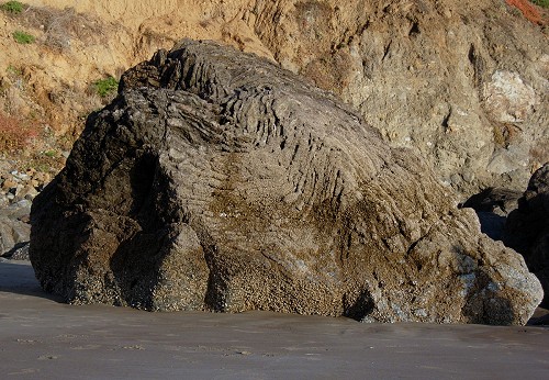
Some of the boulders are straightforward rocks with a single composition, while others like this one are themselves melanges of many different ingredients.
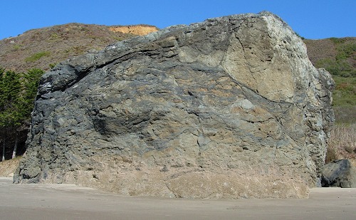
Close up, you may be able to pick out every rock type found in the Franciscan—assembled in a single boulder!
If you visited the rocks of the Marin Headlands a few weeks earlier, you'll recognize the Franciscan ribbon chert here, too, although it's green rather than red. That is due to the low-grade metamorphism that has affected the entire Franciscan in most of Marin.
While you're studying these rocks, take a look at the cliff behind them, which is an intimate mixture of rocks and matrix that keeps crumbling into the waves to yield Stinson Beach's abundance of fresh, dark sand.
I always stay til sundown.
What are your top Bay Area beaches, and why?
37.899 -122.645

 If you can tear your eyes off the sea and sky, Stinson Beach offers a geological feast in its sediments, rocks and structure. Photos by Andrew Alden.