upper waypoint

Geological Outings Around the Bay: Shell Beach

Save ArticleSave Article
Failed to save article

Please try again

Shell Beach, near Bodega Bay. (harminder dhesi/Flickr)

shell beach
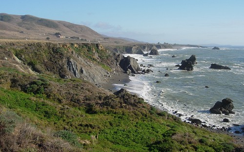
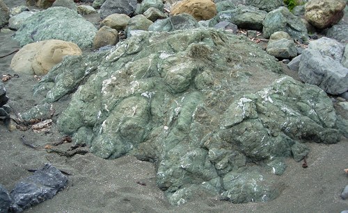
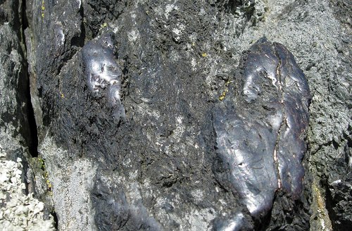
One of California's most distinctive and mysterious bodies of rock is well exposed at Shell Beach, north of Bodega Bay in Sonoma County. Photos by Andrew Alden.

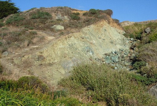
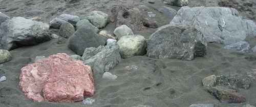
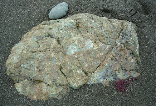
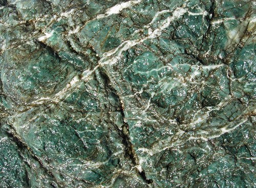
A big swatch of the Coast Range is a set of rocks that once baffled generations of California geologists. It's a dog's breakfast of different things, most of them familiar in the region, mixed together with no pattern that anyone could make sense of. The geologists who explored California were no slouches, but all they could do was to map these suites of rocks in a catch-all category called Franciscan melange.

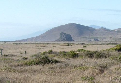
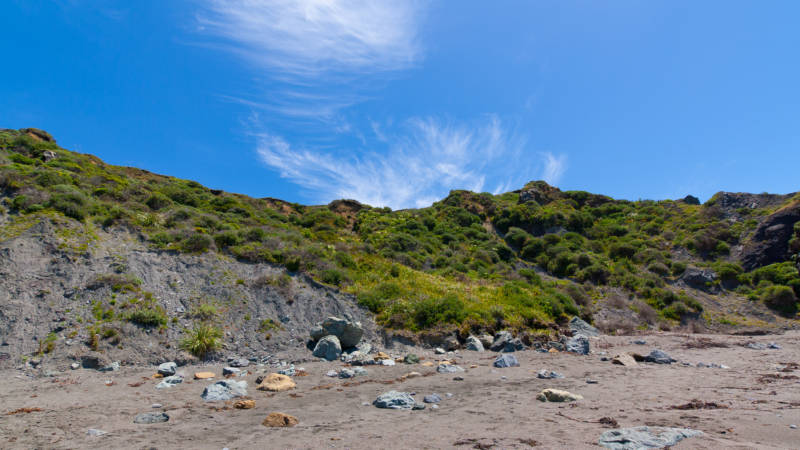
Around 1970 the new theory of plate tectonics found just the place for Franciscan melange, and Shell Beach is just the place to ponder and admire it. I've made several visits there and don't recall any shells—maybe a better name for it is Melange Beach. And right nearby is another mystery from the ice ages. For anyone into geology, Shell Beach is a great workout.

Melange, we now know, is what happens to rocks in subduction zones, which is where one tectonic plate plunges beneath another. Before the San Andreas fault began carrying coastal California sideways to the north, the plate west of us was being subducted directly eastward against North America. (A remnant, called the Juan de Fuca plate, is still doing that off the Pacific Northwest.) Rocks and sediments caught between the plates were mixed and tumbled like snow in front of a snowplow. And that's what melange represents, and that's how the Franciscan got so scrambled. Shell Beach shows us the whole range of the Franciscan in one compact site.

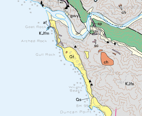
First let's get oriented on the geologic map (from U.S. Geological Survey map MF-2402).

Sponsored

shell beach geologic map

At the top, the Russian River enters the sea at Jenner. Shell Beach is due south of the "Qt" symbol, part of Sonoma Coast State Beach. You can also see it from offshore on the California Coastal Records Project site. "Qt" stands for Quaternary terraces, which I told you about down at Pebble Beach. Up here there are only two terraces mapped, but subtle signs indicate more of them higher up. "KJfs" stands for Cretaceous-Jurassic Franciscan sandstone, but it includes a large share of melange. The tiny orange dot represents Mammoth Rock, which we'll talk about later. Here's the view from the terrace looking south. That's Bodega Head in the farthest distance.

shell beach terrace

The cliffs are all melange. Most of it is a shale and sandstone matrix that has been thoroughly disrupted by tectonic mixing. The sea stacks out in the water are chunks of hard rock within the melange that have resisted erosion. Where these crop out of our rounded oak-dotted hillsides, the local geologists call them knockers. But resistant blocks occur in all sizes, both larger and smaller.

shell beach stair

The stairs down to Shell Beach pass by a big greenish body of serpentinite, our state rock, in the gully. It's worth a detour to inspect them. This soft rock type doesn't form knockers. (I should remind you that all collecting or defacing of rocks is prohibited in this state park.) The beach is small, with dark sand and not much of it, and the coast is cool and breezy—not a place for surfing, picnics or volleyball. What's special about it is the range of rock colors in one place. I'll give you a small sample.

shell beach rocks

The palette does cluster around green and blue. Greenstone, shown below, is ancient seafloor lava that has been changed by time and pressure, but not enough to hide its original pillow shapes.

greenstone

Chert is a flinty rock that acquires subtle translucent colors, setting off its waxy luster, during subduction.

chert

What excites geologists, and may catch your eye, is that Shell Beach also exposes the soft matrix rocks that held and polished these boulders during subduction. Matrix is seldom seen elsewhere because it quickly turns to soil or washes away. In addition to all these is eye candy, things you just want to turn into background images or jigsaw puzzles.

blue chert

If you have time, take the trail north from the beach toward these two ancient sea stacks. The first, Mammoth Rock, is in the center and the second behind it to the right is Sunset Rocks. Some 125,000 years ago, these stood among the waves and endured until the land rose and the sea fell away.

mammoth rocks

The stacks are a mixture of rock types that is largely blueschist, a tough stone formed by high-pressure metamorphism. At Shell Beach, chunks of it extend the palette all the way to indigo. The second stack has a real treat—polished spots that have been interpreted as marks left by ice age mammoths that used the rock as rubbing posts, just as cattle do today. KQED showed you these in its Ice Age Bay Area series in 2008.

mammoth polish

I have presented more detail about the polish here and more about the rocks here.

38.4180 -123.1045

lower waypoint
next waypoint