 Pebble Beach is on the coast just north of Bean Hollow State Beach. Come for the pebbles, stay for the rocks.
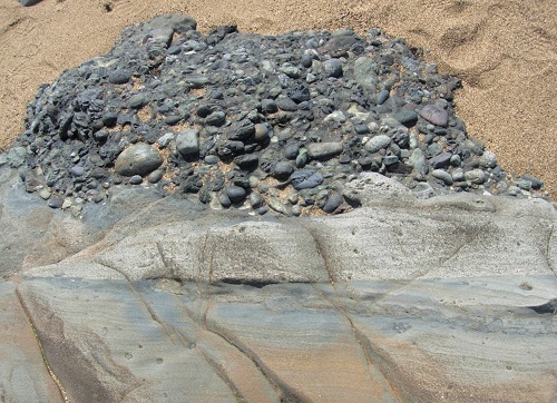
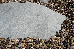
It was a weekday the last time I visited Pebble Beach, on the San Mateo coast just south of Pescadero, and several busloads of children came and went. They flocked to the pebbles, flung them high, and were off in their buses 15 minutes later leaving the beach to me. I did the same here when I was a kid, and you can too—the pebbles are wonderful—but I can show you a better time today.
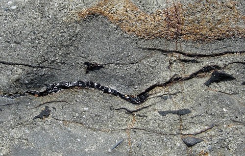
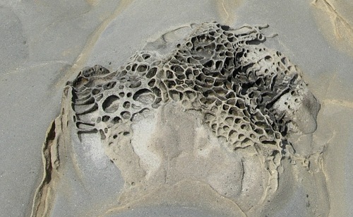
Pebble Beach (also called Bean Hollow Beach North) is a great place to look at the deep sea floor without getting your feet wet. The rocks exposed there are scrubbed clean by surf and nicely tipped up on edge for easy viewing, and they present many instructive mysteries that students actually pay professors and buy textbooks to learn.
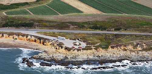
But first, about the pebbles. You get to the beach on Route 1 going south from San Gregorio Beach, which skirts the coast on flat land that is largely planted to artichokes and ranchettes. This tableland is a marine terrace or wave-cut platform. See the setting in the photo below, from the California Coastal Records Project.
The San Mateo coast is famous for these terraces, especially down around Santa Cruz. They are land that was cut flat by the sea during the Pleistocene epoch, then lifted by tectonic activity. The terraces consist of beach sand and offshore sediment from tens of thousands of years ago, and most of the pebbles of Pebble Beach are recycled from that Pleistocene gravel.
Now let's look at the geologic map of the area (from USGS Open-File Report 98-137):
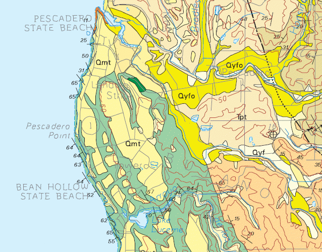
Pebble Beach is right where the symbol that says "63" is. The areas marked "Qmt" are the marine terraces. If you examine the red contours, which show elevation at 50-meter intervals, you'll see that the terraces occupy at least three different levels.
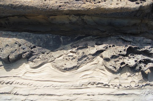
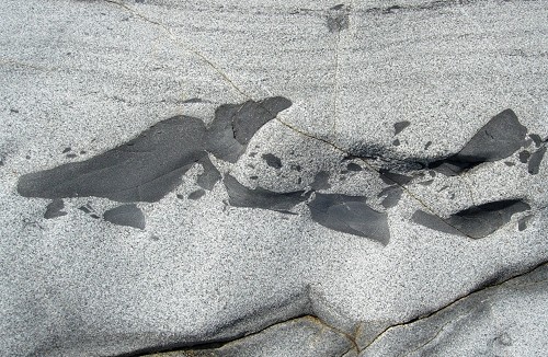
The rocks on the beach, revealed as the terrace is eroded away, are mapped in green and belong to the Pigeon Point Formation, a thick pile of former deep-sea sediments dating from the Late Cretaceous epoch, some time between 100 and 65 million years ago. That "63" symbol means that the beds of rock, originally horizontal, are tilted to an angle of 63 degrees. And here they are, exposed again just as the sea left them in the Pleistocene.
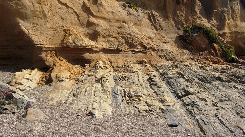
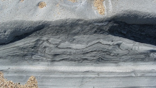
The surface between the steeply dipping rocks and the horizontally bedded terrace deposits is called an angular unconformity. In this case it represents a gap in time of at least 65 million years.