upper waypoint

Rivers in the Sky Can Lead to Flooding on the Ground

Save ArticleSave Article
Failed to save article

Please try again

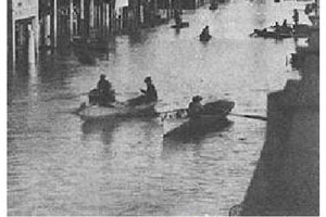
Severe flooding in Sacramento during 1861-1862 storms.

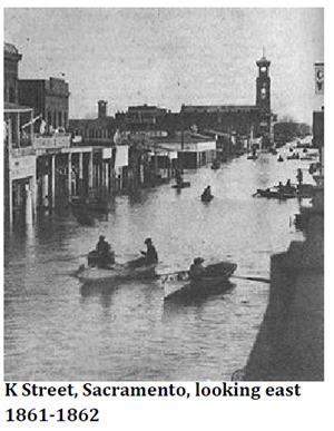
Earth's 4.5 billion year history is riddled with the evidence of landscape-altering events that would be considered rare and catastrophic from a human perspective. Some of the 'normal' events that shape the Earth's surface occur at intervals longer than the lifespan of a human. For example, let's say that an abrupt event (an earthquake, flood, or tsunami) occurs, on average, once every 500 years. Such an event would have occurred more than 5,000 times since our species has walked the Earth.

We have our grandparents and great-grandparents (and written/photographed history for that matter) to remind of us events that did happen. But there's nothing quite like direct experience. The stories of natural disasters that occurred many generations ago seem far away and detached from our current world.

How do we deal with this? One tool to remind ourselves of what is possible when it comes to 'rare' natural events is science. Under the right circumstances and analyzed with the proper tools the geologic record holds clues to how often such events might occur (frequency) and how significant there effects might have been (magnitude). Combining this type of work with sophisticated modeling of the processes at work can provide insight into what to expect.

Sponsored

Following on the very successful ShakeOut Scenario of 2008, the U.S. Geological Survey's Multi-Hazards Demonstration Project (MHDP) is working on another large-scale disaster awareness project. But instead of an earthquake, this one is about large storms.

The project is nicknamed ARkStorm, which refers to storms related to atmospheric rivers (the 'AR') that occur on average once every 500 to 1,000 years ('k' refers to 1,000). The image below is from a USGS publication released last week about the ARkStorm scenario (Open File Report 2010-1312) and shows an example of an atmospheric river in the Pacific in 2004. In this example, this relatively narrow arm of high water vapor content extends across the ocean basin to the town of Cazedero, California.

A storm scenario similar to what is described in the ARkStorm report happened in California in the winter of 1861-1862. A series of powerful storms lasting a month flooded much of the Central Valley -- people described it as an inland sea. The ARkStorm scenario has happened before and is scientifically realistic.

Similar to earthquakes, it's not so much a matter of if a storm scenario like this will occur but when. The point of an initiative like ARkStorm is about raising the collective awareness of what is possible. I think Californians are, for the most part, aware of the seismic hazards we face. Adding a super-storm to the list is not meant to be sensational or scary -- it's meant to communicate the inevitable so we are prepared.

To learn more about how different agencies and authorities will be participating in ARkStorm, check out this short video put together by the USGS:

Thanks to Bay Area geologist and About.com 'guide' Andrew Alden for mentioning this story last week on his blog.

37.762611 -122.409719

lower waypoint
next waypoint