upper waypoint

Geology of the Devil's Slide Area

Save ArticleSave Article
Failed to save article

Please try again

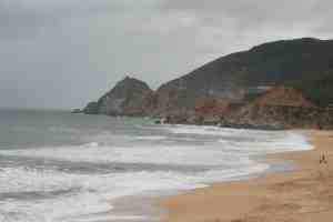
Last week the Caltrans crew working on the tunnel project in the notorious Devil's Slide area on Highway 1 between Montara and Pacifica broke through after three years of construction (see QUEST's story on the breakthrough.) Photo courtesy of terraplanner.

The combination of steep terrain and the geology of the area have made this area prone to landslides since Highway 1 was constructed in the mid 1930s. For example, a slide in 1995 closed the road for more than 150 days and cost $3 million to repair.

The Caltrans' Devil's Slide Tunnels Project aims to remedy this chronic geoengineering issue:

"The project calls for construction of two tunnels beneath San Pedro Mountain, each 30-feet wide and 4,200-feet long. At the northern end, a 1,000-feet bridge will span the valley at Shamrock Ranch. A re-alignment of Route 1 at the southern end will provide safe transition into and out of the tunnel."

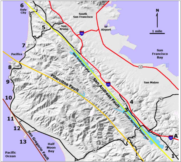
The map below shows major faults in the region (Devil's Slide area is #8 on the map).
Sponsored

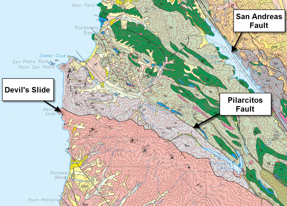
The next map below zooms in a bit more and shows the geology in more detail. The pink color represents the granitic rocks of Montara Mountain (which are exposed quite nicely at Montara Beach). The grayish-purple color to the north and adjacent to the granite is a unit of sandstone, shale, and some conglomerate that is folded and fractured.

Caltrans notes that the chronic landslide problem occurs at the contact of these rock types:

"The Devil’s Slide area begins just west of the pass on the west side of San Pedro Ridge and extends for about 0.8 mile along Highway 1 on the northwest flank of Montara Mountain. The landslide is occurring where steeply dipping, faulted, and folded Paleocene rocks are slipping above a steeply inclined surface of underlying weathered Mesozoic granitic bedrock of Montara Mountain."

The tunnel and road is expected to be completed and opened to the public sometime in 2012. The existing 1.2 miles of Highway is going to be converted into hiking and biking trails.

If you're interested in learning more about this the geoengineering aspects of this project the California Department of Transportation (Caltrans) has a fantastic website with several great explanatory diagrams.

~

Images: (1) Montara Beach / Flickr user Terraplanner; (2) Figure 8-1 from Chapter 8 of The San Andreas Fault In The San Francisco Bay Area, California guidebook from the USGS; (3) USGS Open-File Report 98-137: Geology of the onshore part of San Mateo County, California.

37.58561581962738 -122.51602937467396

lower waypoint
next waypoint