Generalized geologic map of Point Reyes Peninsula. Credit: USGS
The first thing I do when thinking about the geology of an area is to zoom way out and get the big picture. What are the large-scale geologic features to be aware of? This question is especially important in California because we have the relatively unique experience of being able to view how the geology changes across a tectonic plate boundary. The San Andreas Fault system dominates the larger-scale geologic configuration of the greater Bay Area. Before I moved to California I wasn’t used to asking myself the question: What plate am I on right now? But this is something you need to do in this area. The San Andreas Fault system separates the Pacific plate to the west from the North American plate to the east. While the vast majority of the Pacific plate is oceanic crust covered by the ocean from which it is named, there is a good amount of real estate here in California that can be described as chunks of continental crust. These pieces of crust originated hundreds of miles to the south and have been moved northward over many millions of years along the San Andreas Fault system.
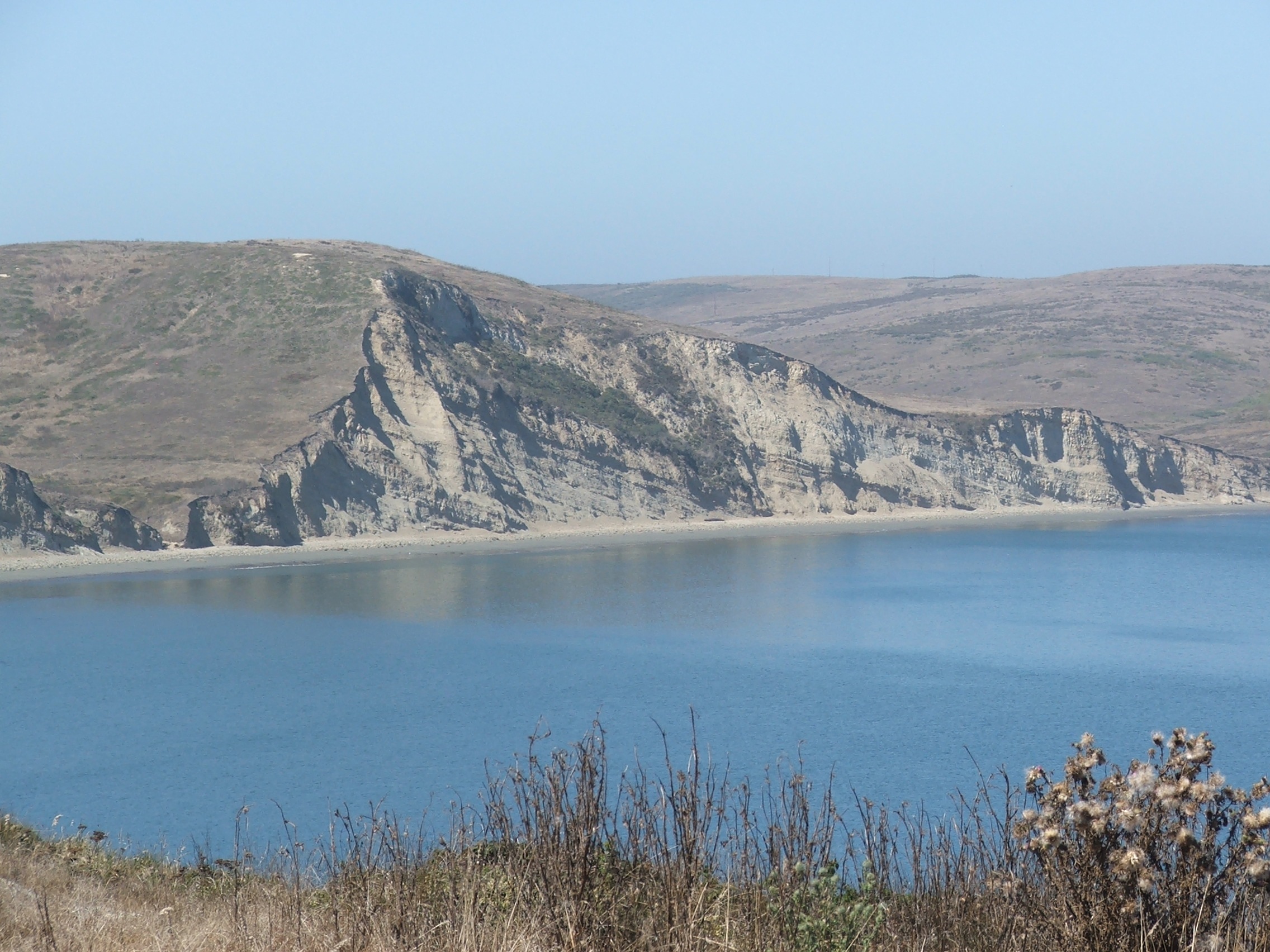
Sedimentary rocks exposed along Drake's Bay (photo courtesy of Brian Romans)
Point Reyes Peninsula is one such chunk that has been moved northward along this plate boundary. I’ve always been struck by how Point Reyes simply looked like it was out of place — there it is, this broad peninsula with large rolling hills separated from the “mainland” by the narrow and elongate Tomales Bay. It turns out that Tomales Bay is there because it marks the trace of the San Andrea Fault zone. In many areas, the fault zone is a zone of fractured and weaker rock and, thus, its more easily eroded and expressed as a valley. In this case, the fault zone is very close to the present coast and partially flooded.
The geology exposed on the Point Reyes Peninsula is unique compared to the geology to the east of the San Andreas. In addition to the main San Andreas fault displacing this area to the north, another fault, the San Gregorio fault, has displaced the peninsula even further north. I know, it’s a bit confusing, but this is what makes California geology so fun! Putting these puzzle pieces back together is in some cases quite straightforward and, in other cases, the focus of decades of scholarly contention.
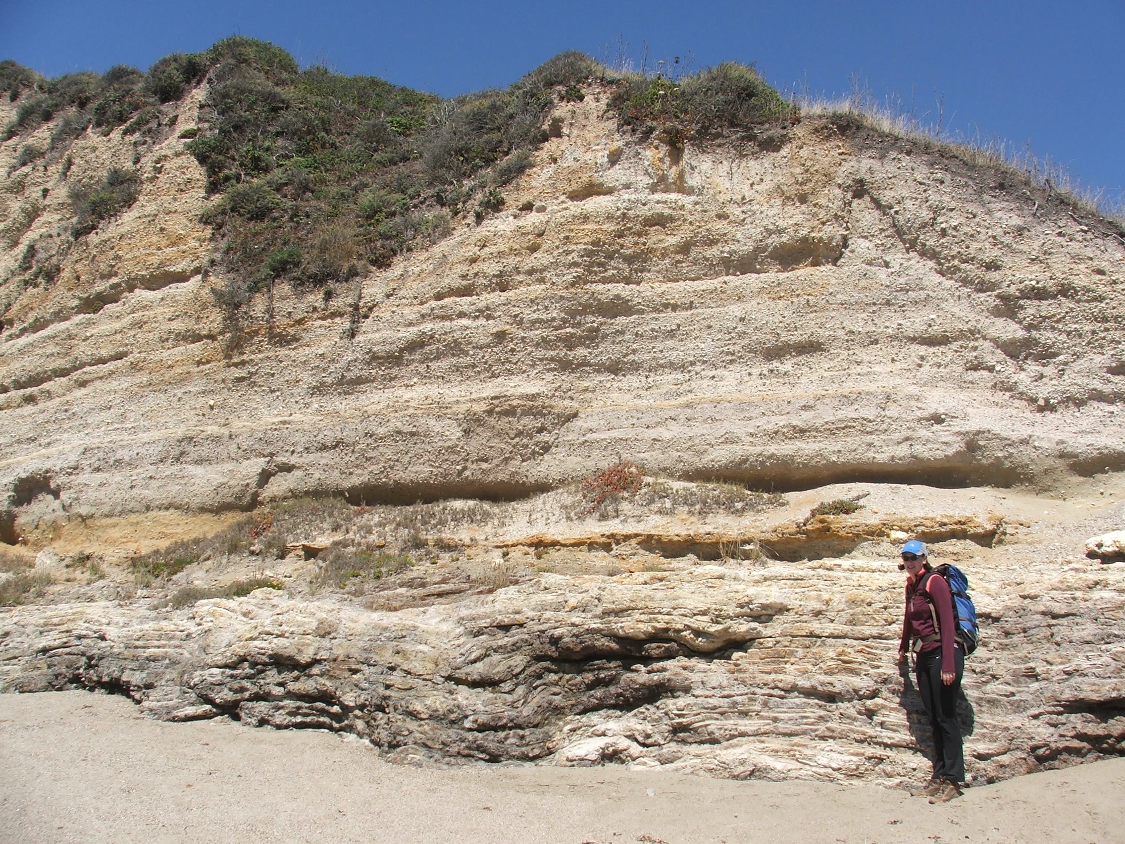
Beach cliff exposures at Sculptured Beach, Point Reyes (photo courtesy of Brian Romans)
The geology on the peninsula itself is fascinating. The Inverness Ridge is a ridge mainly because of the more resistant igneous rock — granite to be specific — that is present there (the pink color in the geologic map above). The green, yellow, and brown colors are much younger, mostly marine, sedimentary rocks that are exposed sporadically on ridges or in valleys inland and also in some beach cliffs along the coast as shown in the photo above.
As the map shows there is a relatively small exposure of the same granite exposed along Inverness Ridge that is present at the lighthouse and Chimney Rock way at the end of the point. If you’ve ever been there you know that the point is also topographically higher. The explanation is that the peninsula itself is broadly folded — the two sides of exposed granite (the pink areas on the map) are bent up with the younger, much more easily erodible, sedimentary rocks sitting on top. In fact, the large estuary called Drake’s Estero is the lowest part of the peninsula because it’s the axis, or lowest part, of this broad fold (that northwest-southeast trending double arrow marks the location of this fold axis).
The features I describe in this post are the larger-scale patterns that are apparent on the geologic map and what can be seen when you find yourself at one of the many sweeping vistas while hiking the peninsula. The USGS field guide I refer to in this post, and many other online and offline references, discuss the geology of Point Reyes in more detail. If you’re out to view the birds in the wetlands, kayaking Tomales Bay, or simply enjoying the beautiful scenery on a hike think about bringing along one of these geologic field guides to give you a bit of context. You don’t need to study it and be an expert — a little bit of knowledge can go a long way in enriching your experience of the Bay Area’s landscape.
-
* The chapter on Point Reyes is only one of numerous chapters highlighting various locations in the greater Bay Area to view geology related the San Andreas Fault system.

 The rocks exposed on Point Reyes tell a geologic story that is uniquely Californian.

