upper waypoint

Producer's Notes: Marine Sanctuary Patrol Flight

Save ArticleSave Article
Failed to save article

Please try again

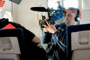
Producer Chris Bauer filming over the Gulf of the Farallones National Marine Sanctuary in NOAA’s Twin Sea Otter plane.

Much of the ocean waters off the coast of California, from Bodega Head to Cambria, have been set aside as national marine sanctuaries. The primary objective of the sanctuaries is to protect our delicate ocean resources while allowing people to use the areas in a sustainable way. While most recreation, commercial fishing, and shipping are still allowed within sanctuary waters, some activities are now strictly regulated or prohibited.

But how do you manage such an enormous area? And how do you keep tabs on what is going on out there? QUEST producers Lauren Sommer, Jenny Oh and I hitched a ride to find out.

On the windswept tarmac of the Sonoma County Airport, a team from the National Oceanic and Atmospheric Administration takes to the skies to patrol large portions of the Cordell Bank, Gulf of the Farallones and Monterey Bay National Marine Sanctuaries.

The mission of our Twin Otter flight crew, pilots Bradley Fritzler and Jason Mansour from NOAA Corps, along with sanctuary observers Sage Tezak and Michael Carver, is to conduct abundance surveys of users in the sanctuaries, counting boats and recording what they are doing and where.

Sponsored

We start out crossing Bodega Bay, flying multiple transects, back and forth, across the rolling seas of Cordell Bank. The engine noise is deafening in the unpressurized cabin. We scan the whitecaps from a mere 1000 feet, going only about 90 knots. The rugged aircraft bucks in the turbulent wind coming off the water. Flying this low and slow would give some pilots the jitters but for the Twin Otter flight crew it’s just a walk in the park. As we reach the Farallon Islands, I pop the back window to get a better camera angle of the “Devil’s Teeth,” and in the process pray our camera doesn’t get sucked out into the abyss. From the Farallones we bank south and head to Ana Nuevo Island. From there we’ll circle back up the coast, past Half Moon Bay and San Francisco, over Pt Reyes National Seashore and return to Sonoma County. Total flight time: 3 hours. In addition to surveying boat use in the sanctuaries, the observers and flight crew will document any other sightings, such as whales and keep a look out for maritime violations.

California has recently established new marine protected areas along the coast. These MPAs will have strict restrictions and some will essentially be closed off to all major use, including fishing. While the State is in charge of enforcing the new regulations, coordination between government agencies may provide additional help with an eye in the sky.

As much as the folks at NOAA might chafe at this description, it’s easy to think of these Twin Otter Survey Flights over the marine sanctuaries as a kind of “cop on the beat.” They’re not out there actively tracking down bad guys as much as they are a presence, keeping an eye on things and making sure everybody is on the up and up. And in that role, they don’t need to be flying everyday combing the ocean, monitoring everyone and every thing, every minute of every day. They may only survey the sanctuaries once every couple weeks. But knowing that today might be the day they are flying over, may help keep users of the marine sanctuaries in line. “Nothing to see here, move along.”

We’ve crossed these waters many times before for QUEST, but always traveling out into the deep blue on small, sea-sick inducing boats. I can tell you for certain, flying over the rough seas and into the wild blue, is a lot more pleasant and efficient. And seeing the Farallones from the birds eye view was clearly inspiring.

38.015305 -123.441445

lower waypoint
next waypoint