
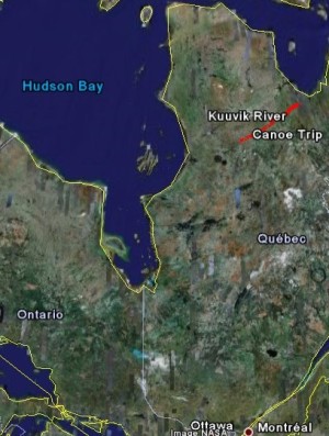
 Nunavik territory, home to the Kuuvik River.This week I am taking a break from the usual astrophysics and cosmology to write about that other hot topic: climate change and global warming. Last summer I went out for an extremely remote 215 mile canoe trip for the International Polar Year to help raise awareness of climate change. I want to share some of that experience now that our website for the trip has been launched.
I was inspired to take this trip by my experiences leading similar, somewhat less extreme trips in northern Ontario and northern Quebec. During this time, I worked summers at a canoe camp located six hours north of Toronto. My job was to put a dozen teenagers on a bus, drive 24 hours to the end of the road, and head out into the Canadian bush for six weeks of travel by canoe and portage. You never know what to expect with these kids when you're several hundred miles from the nearest road, hence the sarcasm implied by my use of the italics above.
At this job I chased down the most remote rivers in Ontario and Quebec that my boss would allow. Each summer I got more into the lifestyle and each summer I wanted to go a little further out. I started to plot my own personal trips into the far-flung reaches of northern Canada that I couldn't reach through this job.
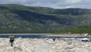 A beloved portage.
Almost ten years later, I was finally offered the opportunity to take one of those trips. A friend from this camp arranged a 3-week long canoe trip and complete sponsorship for four people. The sponsors completed the greenhouse circle from plane flights to carbon offsets. Seasoned canoe trippers, the four of us would run like a well-oiled machine. This was exactly what I had been craving after all those years of teenager drama.