Wednesday afternoon, the San Francisco Bay Area forecast office in Monterey glanced at output from models looking at the eight- to 14-day time period and summarized the outlook for next week this way:
High pressure is then forecast to rebuild over the west next week for a return to warm and dry weather. Latest 8-14 day climate temperature and precipitation outlooks keep the West warm and dry through the March 2-9 period.
The models most forecasters depend on produce new outlooks every six hours. By Wednesday night, models had already spit out a new version of forecast reality for next week. Thursday, the Monterey forecast office had this to say about conditions next week:
The second half of next week is starting to look more interesting on the medium range models. By Wednesday a third weak system skirts the North Bay again. However, a more promising system looks to really break down the ridge with the best chance for rain the next seven days. Therefore, have introduced widespread precipitation for the entire Bay Area next Thursday and Friday. Confidence is not the highest given that it is seven days out. But model consensus indicates a good push of precipitation.
As the weather people say, both pros and geeks, we'll see if the forecast verifies.
While we wait for the models to settle and/or reality to happen, let's observe that one of the many benefits of our infuriatingly gorgeous winter weather is that it creates great conditions to see California from space. Not that we've ever been up there ourselves, but here's one recent example: astronaut Scott Kelly's Super Bowl Sunday shot of San Francisco.
For those confined to the lower troposphere, the view from space is available via sites like NOAA's GOES West weather satellite site or NASA's Worldview.
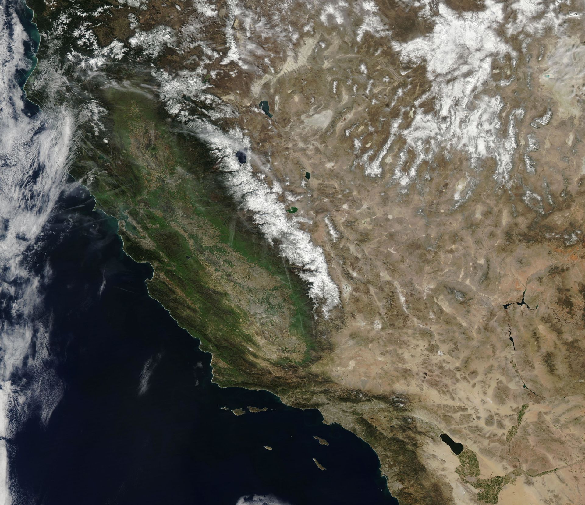
Worldview is a favorite. It features images of the Earth captured daily by two NASA satellites, Aqua and Terra. During the summer, we often check it to watch the visible dispersal of wildfire smoke. In the midst of our recent dry, mostly cloud-free weather, Worldview has offered day after day of clear California portraits. Since the site has an archive of images going back to 2013, it also allows a comparison between this year's conditions and what the state looked like earlier in our four-going-on-five-year drought.
The image at the top of the post is from Wednesday, Feb. 24, 2016 (original Worldview image here. The slider below compares that image to one captured exactly a year earlier, Feb. 24, 2015 (original image here).
A year ago, the state was on its way to recording its lowest snowpack in recorded history. That's not necessarily obvious in the 2015 image, which was recorded just a day after a storm had moved across the southern half of California. The really telling difference between this year and last year is the shocking dearth of snow in the northern mountains.
The statewide snowpack is now about 90 percent of normal for the date -- and shrinking. So you sure hope that maybe the weather models will be right about an upcoming change in the weather. Never mind a miracle. We'd settle for some March moisture.