Access roads will shut down at 11 p.m.
The bridge itself will be off-limits starting at midnight.
"But really you don't want to be anywhere in the area from 10:30 or 11 on, because you could get stuck," said Clemens.
The bridge will reopen Monday at 4 a.m.
Here's a schedule of road closures around the bridge:
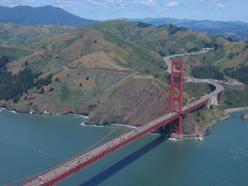
North End of the Golden Gate Bridge - Friday, Jan. 9
- At 8 a.m.
- Southbound Hwy 101 offramp at Rodeo Avenue (see map)
- At 8 p.m.
- Parking lots at north end of bridge (see map)
- Alexander Avenue at Conzelman (see map)
- At 11:30 p.m.
- Southbound Hwy 101 at Marin City (see map)
- Southbound Hwy 101 onramp at Spencer Avenue (see map)
- Southbound Hwy 101 onramp at Alexander Avenue (see map)
- Northbound Hwy 101 onramp at Alexander Avenue (see map)
South End of the Golden Gate Bridge - Friday, Jan. 9
- At 8 p.m.
- Parking lots at south end of the bridge (see map)
- At 11:30 p.m.
- Northbound Hwy 101 at Marina Boulevard & Richardson Avenue (see map)
- Northbound Hwy 1 at Lake Street (see map)
- At 11:45 p.m.
- Northbound Hwy 101 offramp at Merchant Road (see map)
- Southbound Hwy 101 offramp at Merchant Road (see map)
The Marin Independent Journal has some more-specific closure info for southbound drivers:
Marin residents driving south on Highway 101 will encounter the closure at the Marin City/Sausalito off-ramp. Lanes will taper down beginning just south of the East Blithedale/Tiburon Boulevard exit and continue to Marin City, where all traffic will be forced to exit. People wanting to get to Sausalito will have to take Bridgeway into and out of town. All other on-ramps/off-ramps will be closed out of Sausalito.
Alternate Travel
Golden Gate Transit buses will still offer service across the bridge. Click here for weekend current bus schedules. Routes 10 and 17 & late-night Route 70 trips will NOT operate in Sausalito. Use free shuttle and make all connections in Marin City.
Golden Gate Ferry: Added early-morning to late-night service on Larkspur Ferry. Late-night service added to Sausalito Ferry weekend schedules. Click here for ferry schedules.
Richmond- San Rafael Bridge: To see what traffic's like on the bridge, click on this Google Map. A Caltrans spokesman told the Marin Independent Journal that the Golden Gate Bridge closure will mean lots of extra vehicles on this alternate route to and from the North Bay. "We expect it to be as busy as it is during the work week," Bob Haus said. "People should leave extra time to get where they are going."
So Long "Suicide Lane"
If you're feeling particularly inconvenienced, know that the bridge is being closed for a good reason: to replace the plastic pylons that now separate northbound and southbound traffic with a movable, 1-foot wide median barrier that bridge officials say will "virtually eliminate crossover collisions."
Some locals have grimly dubbed the lanes closest to oncoming traffic the "suicide lane" because of all the accidents involving vehicles crossing over onto the wrong side of the pylons. The San Francisco Chronicle reported in May that of the 36 people who have been killed in accidents on the bridge since 1970, 16 died in crossover collisions.
The last fatality on the bridge, however, occurred in 2001, and the Golden Gate Bridge Highway & Transportation District says the accident rate has been significantly reduced since the 1980s due to the reduction in speed limit over the bridge to 45 mph, wider driving lanes and increased traffic enforcement.
(To hear about the effects of a nonfatal head-on collision on the bridge, listen to Mina Kim's interview earlier this week with Dr. Grace Damman, who survived one with another vehicle driven by someone who fell asleep at the wheel. Damann, who lobbied for the new median, is the subject of the documentary "States of Grace.")
The New Barrier
Here's how the district describes the new traffic division system that's being put in place:
The barrier will be installed on the 1.7-mile-long Bridge and on the approach portion of Highway 101, north of the Golden Gate Bridge, starting at Alexander Avenue. Using transfer machines, the barrier will be moved several times a day to create more lanes in a particular direction to accommodate variable traffic demands such as the morning and evening commutes.
A new merge will be very different for southbound vehicles. Where drivers currently merge from left to right, the new merge will be from right to left. In addition, the speed limit will be dropped to 45 miles per hour from the current 55 miles per hour on the descent down the Waldo Grade. Lastly, with the installation of the barrier, the two inside lanes will lose 6-inches of width. Getting used to driving next to the barrier may take some adjustment for some drivers, and the District advises motorists to take it slow and get used to the new driving conditions.
The movable media barrier system consists of approximately 13,340 feet of 12-inch-wide and 32-inch-high "steel-clad units filled with high-density concrete tightly pinned together to form a semi-rigid median barrier," the district says, plus two barrier transfer machines, aka zipper trucks.
The projects will cost about $30.3 million, the district says. About 19 percent of that will come from toll revenue.
Here's an animated video of what the new configuration will look like: