upper waypoint

3.6 East Bay Quake Felt Throughout Region

Save ArticleSave Article
Failed to save article

Please try again

If you think you felt an earthquake at 7:05 p.m. in the Bay Area, you did. The U.S. Geological Survey reports that it was magnitude 3.6 tremor with an epicenter just outside the northwest Contra Costa County town of Hercules.

Note: The 3.6 shake was 65 minutes past the time, and much less Rapture-causing, than the earthquake predicted for this evening by radio evangelist Harold Camping.

Links
U.S. Geological Survey: Magnitude 3.6, San Francisco Bay Area, California
U.S. Geological Survey: 'Did You Feel It?' event page
KQED News Fix: At Harold Camping's Family Radio, It's Business as Usual on Air
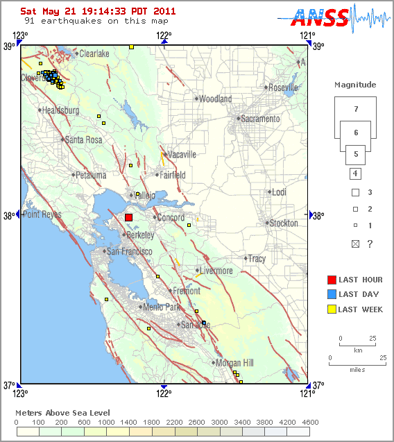
U.S. Geological Survey locator map of May 21, 2011, earthquake epicenter.

Sponsored

lower waypoint
next waypoint
California Preschools Wrestle to Comply With State’s Tightened Suspension RulesSan Francisco’s New Parking Rules Set to Displace RV Community Near SF StateA New Bay Area Clásico? SF's El Farolito and Oakland Roots Set to Battle in HaywardWhy Nearly 50 California Hospitals Were Forced to End Maternity Ward ServicesStunning Archival Photos of the 1906 Earthquake and FireWhat the 99 Cents Only Stores Closure Means to CaliforniansDemocrats Again Vote Down California Ban on Unhoused EncampmentsFederal Bureau of Prisons Challenges Judge’s Order Delaying Inmate Transfers from FCI DublinCalifornia Legislators Take Aim at Construction Fees to Boost HousingFirst Trump Criminal Trial Underway in New York