This report contains a correction.
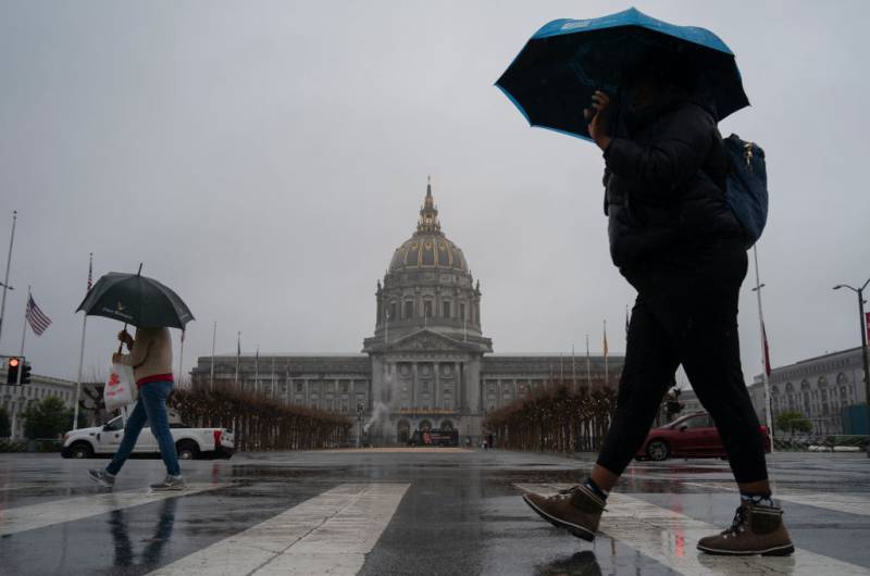
A cold front likely to reach the Bay Area on Tuesday is expected to bring freezing temperatures, strong winds and the potential for snow, according to the National Weather Service.
Roger Gass, a meteorologist with the weather service, told KQED that a cold air mass currently over western portions of Canada will be dropping southward across the Pacific Northwest, reaching Northern California on Tuesday.
“With that cold front we could see a little bit of light precipitation, but for the most part, most of the region will remain dry,” Gass said. “It’s going to stay cold and windy, especially with that front. We’re going to see really strong wind gusts along the coastal ranges and along the coast, especially from about midday Tuesday through Wednesday.”
Those winds might reach speeds of up to 50 mph along the coast and near mountaintops, according to the National Weather Service.
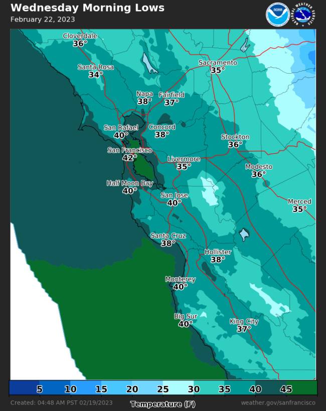
Cold temperatures will likely persist through the end of the week, Gass said, with inland areas facing the worst of it.
“By Thursday and Friday, we may see daytime temperatures struggle to even get out of the 40s in many locations,” Gass warned. “Overnight lows are also going to be widespread in the 30s and potentially even to the coast … The coldest interior valleys could drop into the 20s as well.”
Some snow is expected on the higher peaks of the East Bay hills, but residents will have better odds of catching some snow if they look toward the Santa Cruz Mountains and southward, where precipitation also will be concentrated.
“Our potential for snow across the peaks and the higher elevations of the Bay Area is increasing. It’s looking like we have at least a good 50 to 60% chance, a medium confidence, of seeing some of the higher peaks across the region get some snow,” Gass said.
Gass said places along the Big Sur coast and mountain peaks in the Santa Lucia Range could see up to a foot of snow.
The extreme cold should abate by next weekend, according to Gass, with temperatures back in the 50s. But that won’t last for very long, because meteorologists expect another weather system to reach the Bay Area toward the end of the month.
Feb. 20: This story originally included a misspelling of a meteorologist's name.
KQED's Annelise Finney contributed reporting to this story.