upper waypoint

Bay Area Could See More Rain This Week, Travel Troubles Likely in Tahoe Region

Save ArticleSave Article
Failed to save article

Please try again

The person holds an umbrella and walks by themselves. The Bay Bridge and Yerba Buena Island are visible in the background but the heavy rain makes them hard to locate.
A person walks along the Embarcadero in San Francisco on Dec. 13, 2021. While forecasters are not expecting the Bay Area to experience another atmospheric river this week, they are advising residents to prepare for minor flooding, slick roads and the potential for debris flows and mudslides. (Beth LaBerge/KQED)

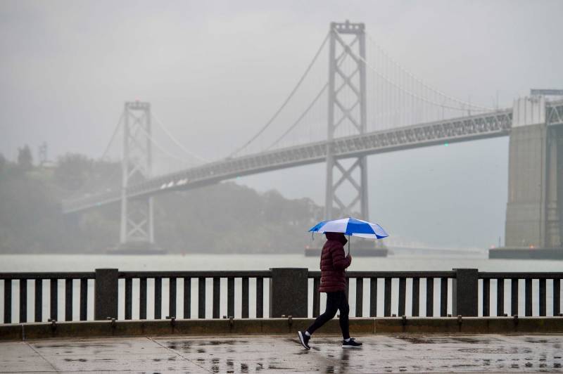
California is facing a stormy holiday week, with more rain expected in the Bay Area and heavy mountain snowfall in the Sierra, forecasters said Sunday.

The National Weather Service predicts a rainfall of 2-3 inches for the week in San Francisco, the Peninsula and the East Bay. Parts of the North Bay also will see a similar amount, but areas farther north, like Cloverdale in Sonoma County, could end up getting 3-4 inches. The South Bay could see a bit less precipitation, with 1.5-2 inches of rain predicted for San José.

While these rain totals are expected over the course of the week, the NWS shared on Twitter that residents should still prepare for minor flooding, slick roads and the potential for debris flows/mudslides.

Successive waves of precipitation moving across the rest of northern California from Tuesday through Sunday afternoon will coat parts of the Sierra Nevada with 1 to 5 feet of snow and possibly up to 8 feet at some higher elevations, the NWS said.

Forecasters added that travel may become very difficult over the Sierra later in the week, with very heavy snow predicted for Christmas Eve and Christmas Day in the Tahoe region and the Mono County span of U.S. 395. South Lake Tahoe could see 36-48 inches of snow in this period, while the town of Kyburz, along U.S. 50, could get 48-60 inches.

The NWS has advised those planning to travel through the Tahoe region and northeastern California to consider alternate plans.

Storms may also bring potential for significant low-elevation snow, forecasters said, including over the I-5 north of Redding, an area where last week’s storms shut down the highway for nearly 24 hours.

“Gusty winds will further reduce visibilities during this event with local whiteout conditions possible,” forecasters said. “Holiday travelers should prepare for winter driving conditions by packing chains, warm winter clothes, and extra food and water.”

label ='KQED's Climate Coverage'

The wet weather pattern will begin to affect southern California Tuesday night and bring rain and high-elevation snow through Thursday, followed by unsettled and showery weather through the weekend.

The Los Angeles weather office said water vapor imagery over the Pacific shows an atmospheric river developing as moisture streams from an area east of Hawaii.

If you're planning to travel in the Sierra region or other parts of California affected by the snowstorm, you can call the Caltrans highway information service for road conditions at (800) 427-7623.

This post includes reporting from KQED's Carlos Cabrera-Lomelí.

Sponsored

lower waypoint
next waypoint
Pro-Palestinian Protests Sweep Bay Area College Campuses Amid Surging National MovementState Court Upholds Alameda County Tax Measure Yielding Hundreds of Millions for Child CareYouth Takeover: Parents (and Teachers) Just Don't UnderstandSan José Adding Hundreds of License Plate Readers Amid Privacy and Efficacy ConcernsCalifornia Law Letting Property Owners Split Lots to Build New Homes Is 'Unconstitutional,' Judge RulesViolence Escalates in Sudan as Civil War Enters Second YearSF Emergency Dispatchers Struggle to Respond Amid Outdated Systems, Severe UnderstaffingLess Than 1% of Santa Clara County Contracts Go to Black and Latino Businesses, Study ShowsHow the Supreme Court Case on Homelessness Could Affect the BayCalifornia Moves to Create a 'Sanctuary' for Arizona Women Seeking Abortions