upper waypoint
A section of Lake Oroville, shown July 22, 2021, when it had fallen to 27% of capacity.  Justin Sullivan/Getty Images
A section of Lake Oroville, shown July 22, 2021, when it had fallen to 27% of capacity.  (Justin Sullivan/Getty Images)

Lake Oroville Shows the Shocking Face of California's Drought

Lake Oroville Shows the Shocking Face of California's Drought

Save ArticleSave Article
Failed to save article

Please try again

Updated July 24, 2021, to correct the elevation of Lake Oroville's all-time low in 1977.

C

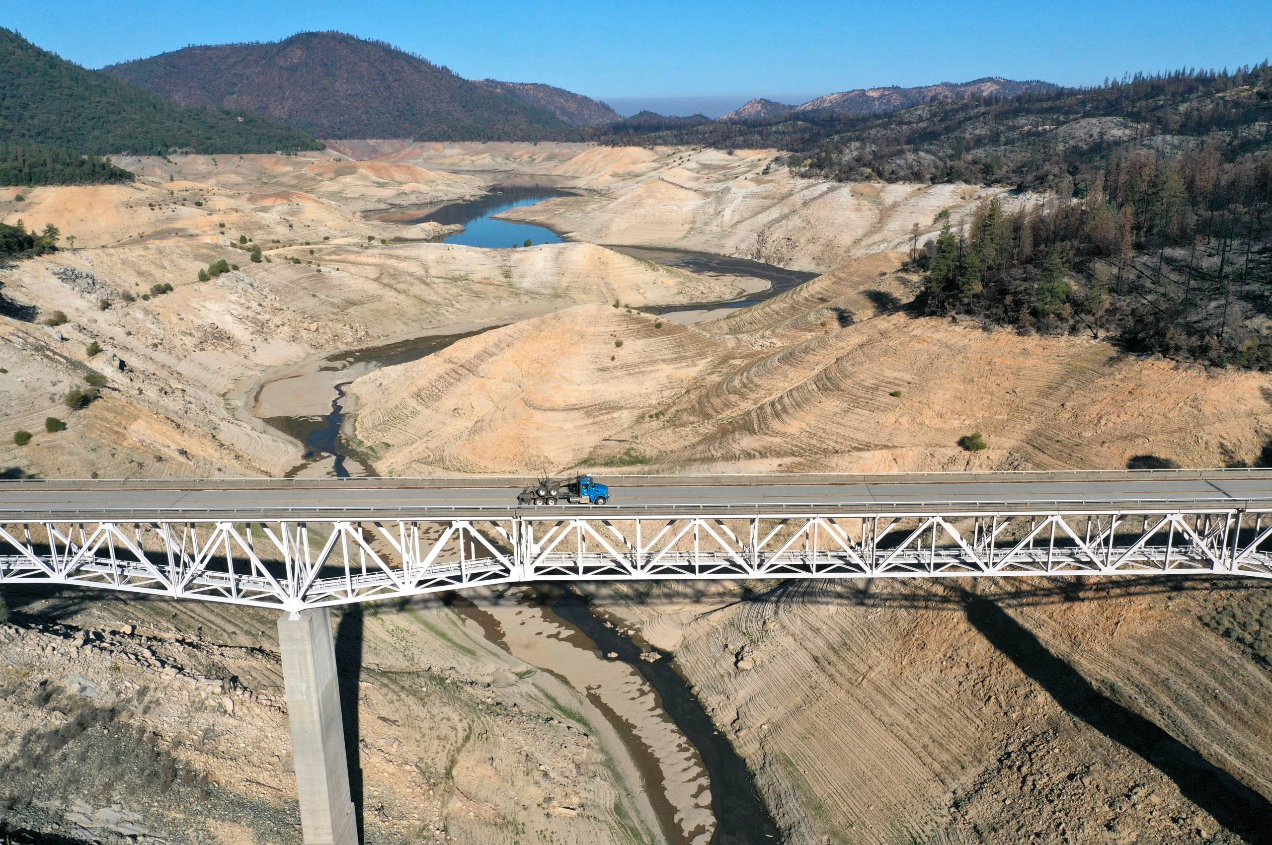
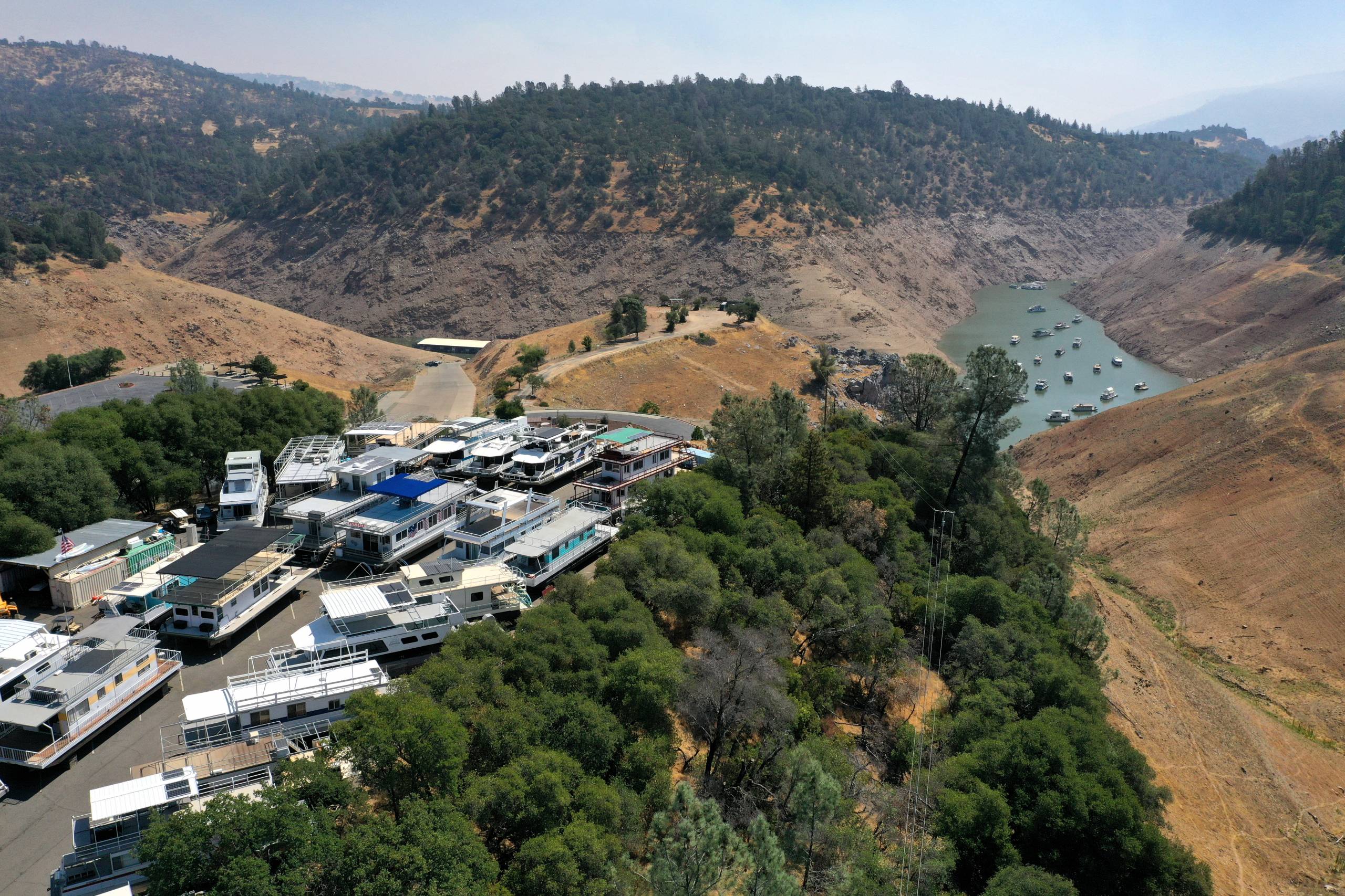
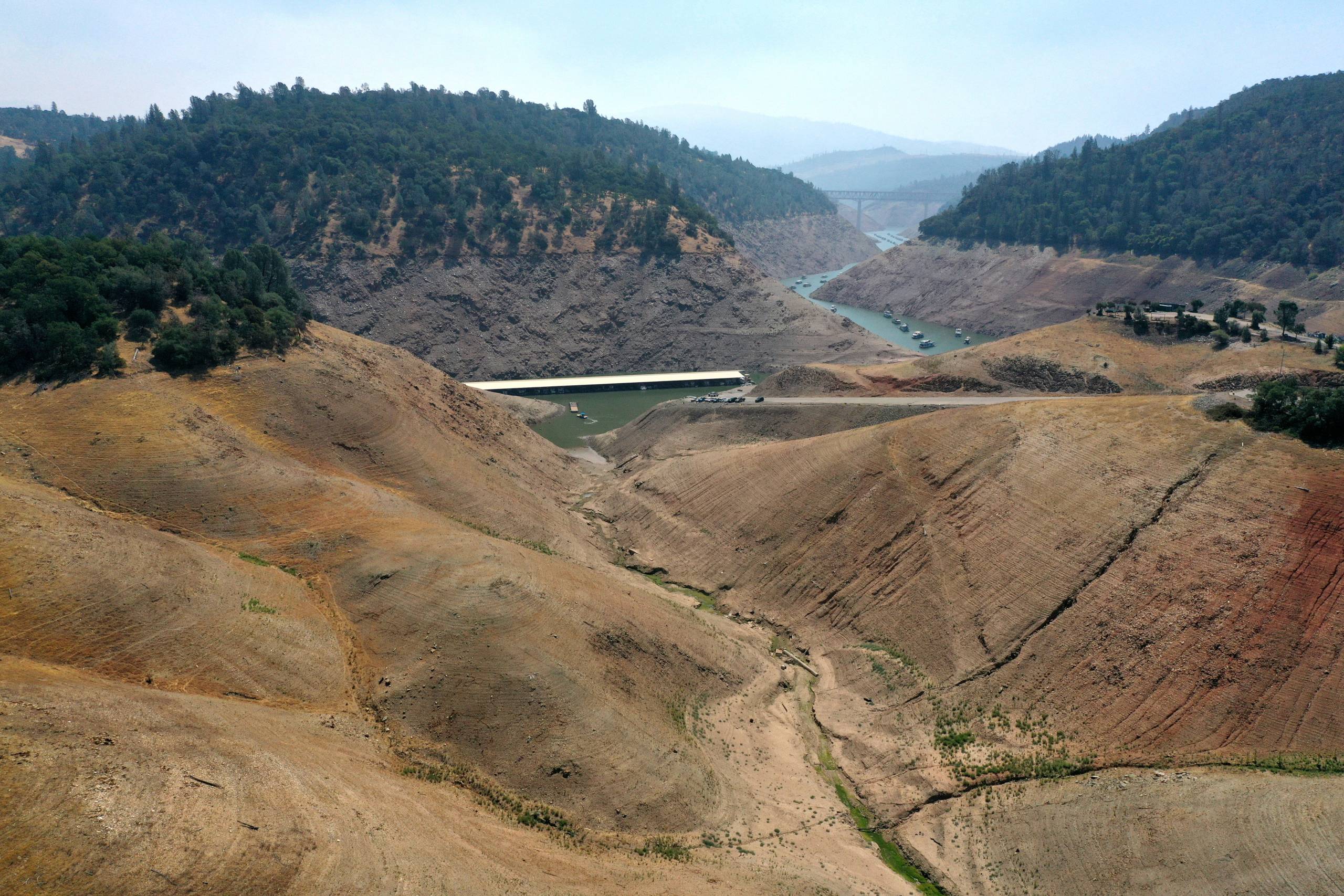
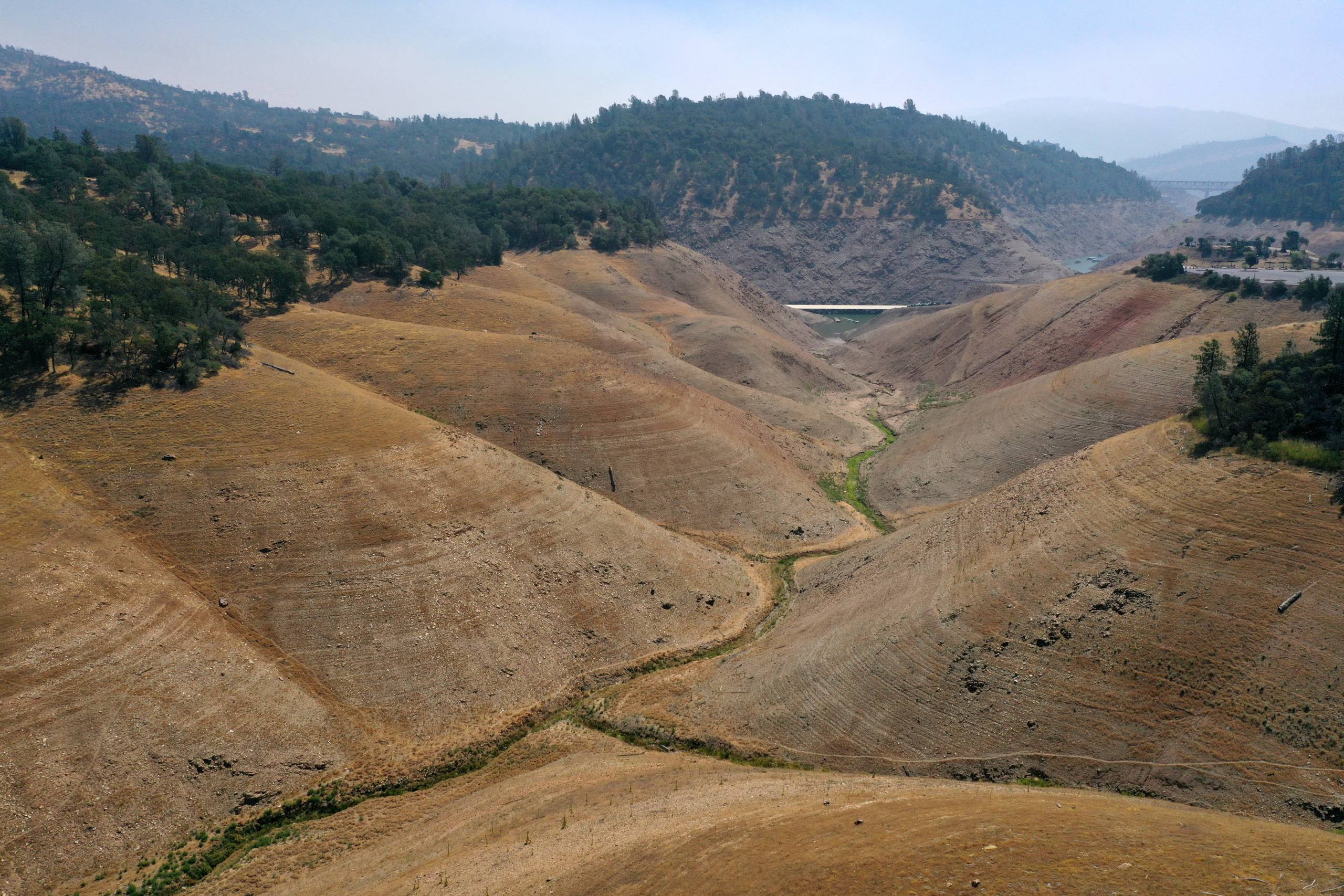
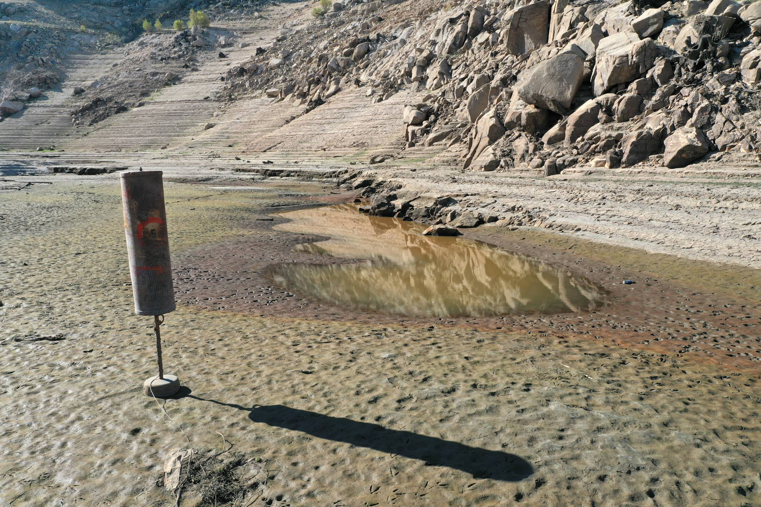
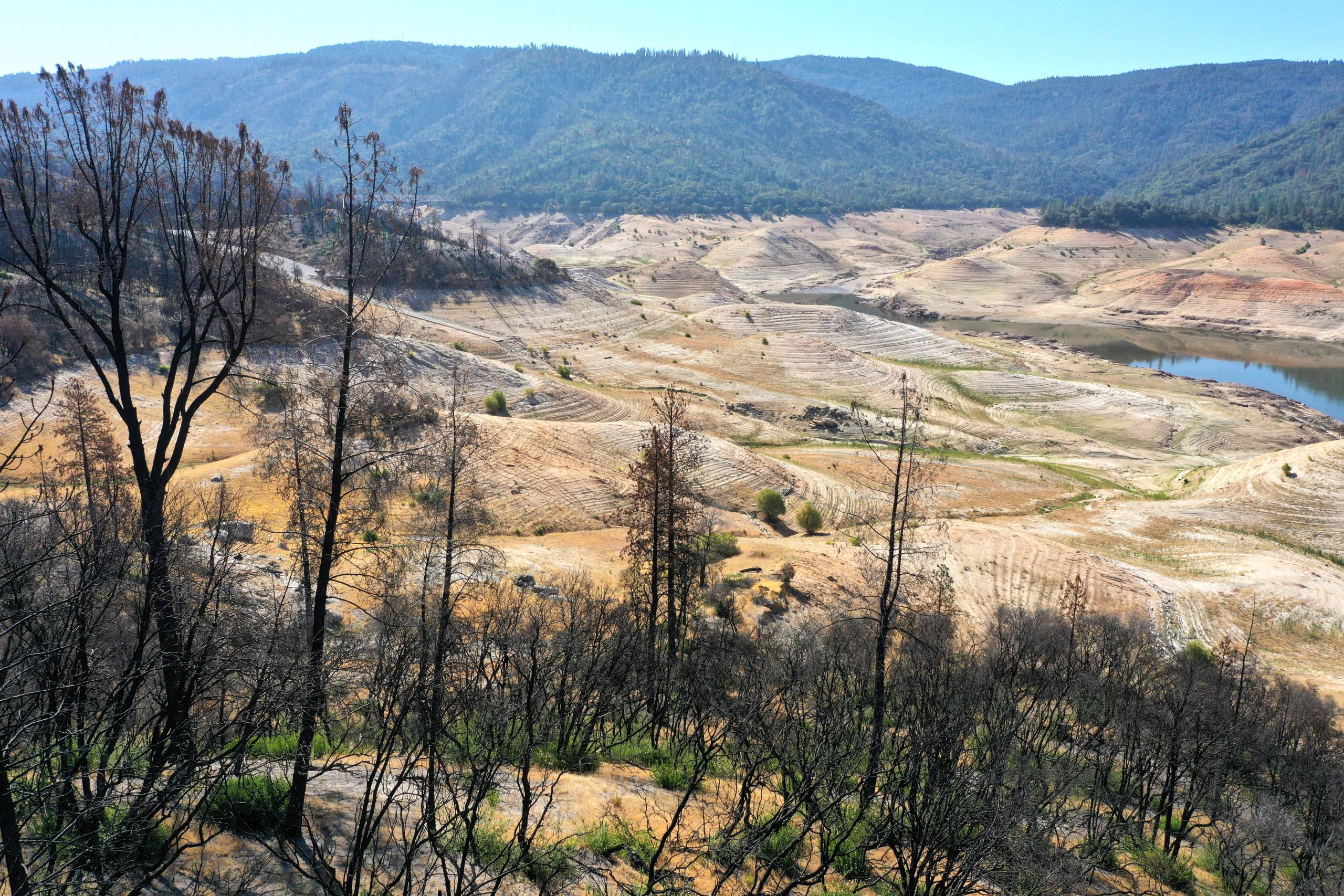
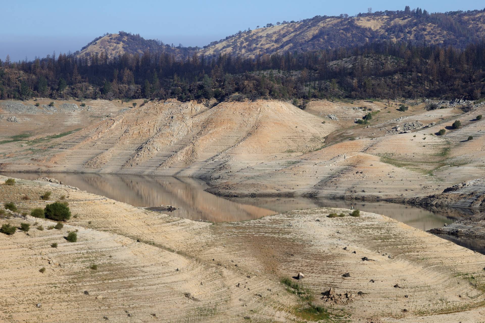
alifornia has descended deep into one of the worst droughts in its recorded history. And perhaps no single location shows more starkly how deep that really is than Lake Oroville, the state's second-largest reservoir and a crucial source of water supply for the state's farm and city water users alike.

San Francisco-based Getty Images photographer Justin Sullivan has been visiting the lake off and on since the driest days of our last severe drought, in 2014.

"Lake Oroville provided the most stunning and visible evidence of loss of water" during that five-year drought, Sullivan said in an interview with KQED Friday.

It's the same now, with much of the reservoir's shockingly barren floor exposed. Adding to the effect around parts of the lake: the charred skeletons of trees burned during last summer's North Complex fires.

Sullivan visited the lake in April and again this week. While the lake's appearance in the spring was riveting, it's alarming now. "To be able to show the difference, actually show it, I think is important because a lot of people still don't view this as anything being wrong," he said. "I thought the last drought was bad, but I'm kind of fearful of what this is."

Here's a selection of Sullivan's latest batch of images, followed by a more detailed description of the situation at Lake Oroville:

In an aerial view, the Enterprise Bridge crosses over a nearly waterless section of Lake Oroville on July 22, 2021. (Justin Sullivan/Getty Images)
House boats sit in a parking lot at Lime Saddle Marina at Lake Oroville on July 22, 2021. (Justin Sullivan/Getty Images)
Low water levels are visible at Lime Saddle Marina at Lake Oroville on July 22, 2021. (Justin Sullivan/Getty Images)
A completely dewatered arm of Lake Oroville, with Lime Saddle Marina visible in the distance, on July 22, 2021. (Justin Sullivan/Getty Images)
A buoy sits on the exposed floor of Lake Oroville on July 22, 2021. (Justin Sullivan/Getty Images)
Trees burned by the 2021 North Complex fires line the steep, exposed shore of Lake Oroville on July 22, 2021. (Justin Sullivan/Getty Images)
Site of a home burned in the 2020's North Complex fires overlooks the dwindling waters of Lake Oroville, July 22, 2021. (Justin Sullivan/Getty Images)

L

ake Oroville backs up behind Oroville Dam, 130 miles northeast of San Francisco, just at the point where the forks of the Feather River pour out of the northern Sierra foothills into the Sacramento Valley.

When the reservoir is full, the surface of the lake stands at 900 feet above sea level. The last time it was near that level was a little over two years ago, when it reached 896 feet, or 98% of capacity.

At that level, the lake is holding enough water to supply about 7 million average California households for a year. But our reservoirs are there to be drawn down. In Oroville's case, the water behind the dam is meant to be shipped by way of the Feather and Sacramento rivers, the Delta and California Aqueduct, among other waterways, to water agencies and irrigation districts serving 27 million people and 750,000 acres of farmland.

As we near the end of July 2021 and enter the driest months of the year, Lake Oroville is slowly but surely emptying out. As you've read, heard and no doubt observed, that's because of two straight extremely dry winters. The reservoir now stands at 655 feet, about 27% of capacity.

Sponsored

To make the numbers less abstract, the lake's record low, 645.11 feet, was recorded Sept. 7, 1977, near the end of what was then the state's worst recorded drought. The reservoir has dropped a little more than a foot a day on average this month as the Department of Water Resources, which manages Oroville Dam, makes releases to meet water quality and wildlife requirements.

The water agency has warned that it will be forced to suspend the operation of Oroville's hydroelectric power plant when the lake reaches the 630 to 640 foot level. At the current rate of decline, the lake could reach that point in the next 10 to 15 days.

lower waypoint
next waypoint
California Law Letting Property Owners Split Lots to Build New Homes Is 'Unconstitutional,' Judge RulesAlameda: The Island That Almost Wasn’tJust Days Left to Apply for California Program That Helps Pay for Your First HouseIn Fresno’s Chinatown, High-Speed Rail Sparks Hope and Debate Within ResidentsNPR's Sarah McCammon on Leaving the Evangelical ChurchUC Regent John Pérez on the Gaza Protests Roiling College CampusesIs California Headed For Another Tax Revolt?KQED Youth Takeover: We’re Getting a WNBA TeamUSC Cancels Main Graduation Ceremony Amid Ongoing Gaza ProtestsSan José Adding Hundreds of License Plate Readers Amid Privacy and Efficacy Concerns