upper waypoint

Heat Map (Literally): Real-Time Interactive Wildfire Trackers

Save ArticleSave Article
Failed to save article

Please try again

A wildfire in La Crescenta, Calif., 2009. (Anthony Citrano/flickr)

Easy with the fireworks this weekend, folks!

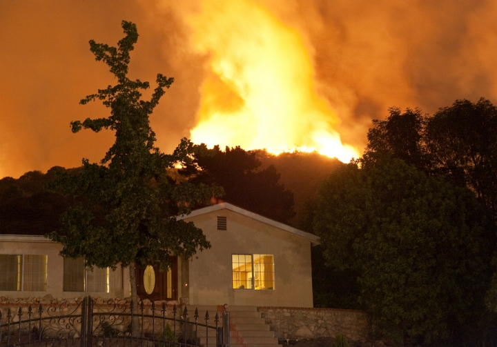
Wildfire season is upon us, as California and other bone dry western states brace for what is all but guaranteed to be another flammable summer.

Below is a map created by CAL FIRE., which provides general locations and perimeters of major active fires burning in California. Under that, a map of active fires currently burning throughout the entire West, including a surprisingly large string in Alaska. Created by Climate Central, the map uses real-time data provided by the US Geological Service's Geospatial Multi-Agency Coordination Group, a web-based mapping application providing current fire locations and perimeters. Zoom in to see fire perimeters. Other good, continuously updated government wildfire reporting sites include the National Interagency Fire Center and the InciWeb Incident Information System.


br>


Sponsored

lower waypoint
next waypoint
Why So Many Central Americans Are Seeking Asylum in the U.S.Real-Time Interactive Earthquake Map: Get to Know Your Local FaultsIt's Really Happening! This Is What KQED's Youth Takeover Looks LikeWhen Rivers Caught Fire: A Brief History of Earth Day (with Lesson Plan)A Look Inside the Youth Vaping CrazeIt's Almost Tax Day. This Is How the Government Spends Your Hard-Earned CashIs the Endangered Species Act at Risk of Extinction?March Madness and the Money: Should College Athletes Get Paid?How to Stop a Nuclear War: The Non-Proliferation Treaty, ExplainedMAP: What Does the U.S.-Mexico Border Really Look Like?