[http_redir]
 Florida might not like to talk about climate change, but here in drought-stricken California, the topic's not so taboo. Mired in year four of the worst drought on record, Californians are witnessing the climate literally change before their eyes. As the state nears the end of one of the warmest, driest winters on record, with Sierra snowpack and statewide reservoir water levels at alarming lows, the evidence is pretty hard to ignore.

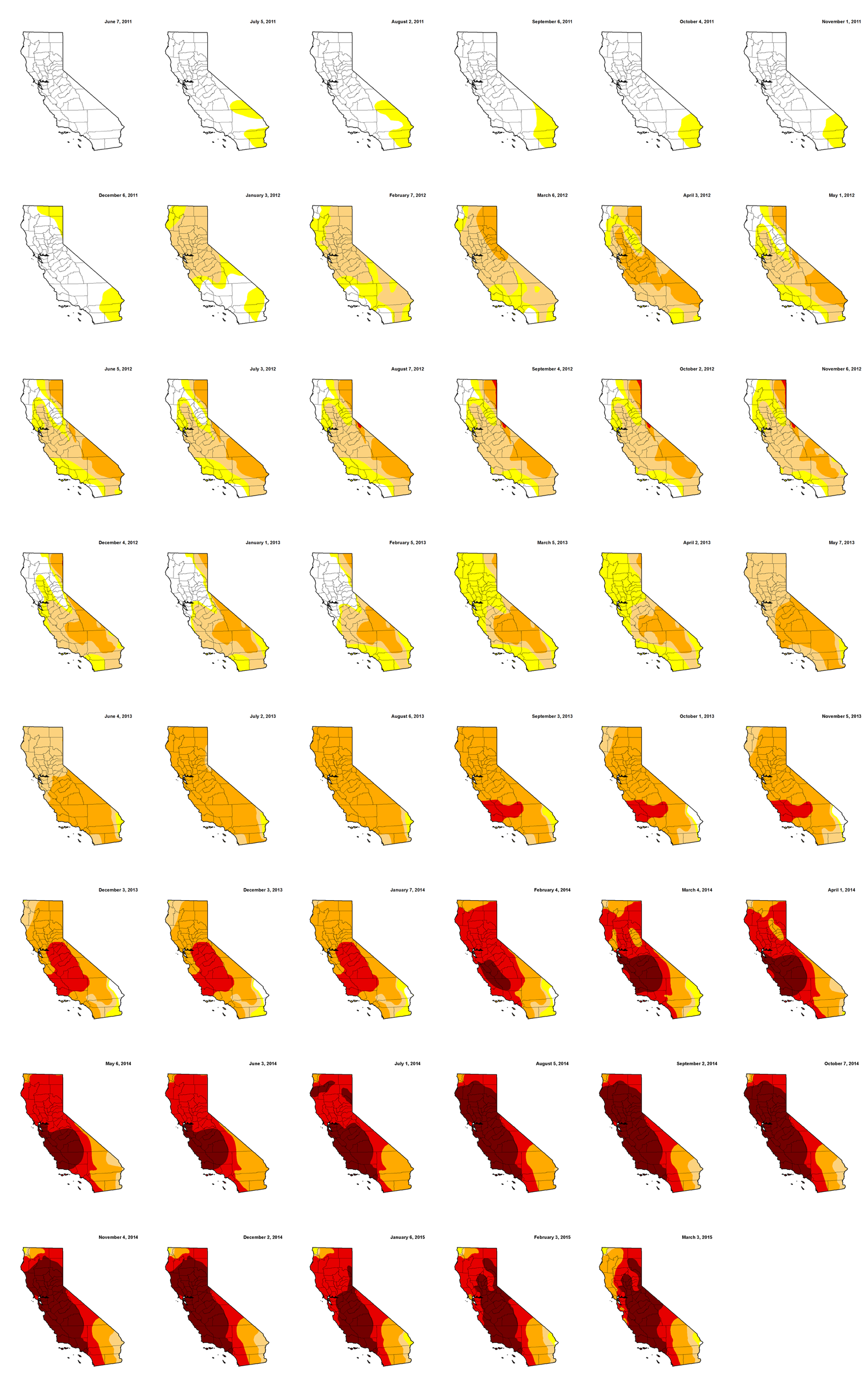
The GIF above -- set to the beat of Nelly's Hot in Herre (yes, double "r") -- features a collection of monthly map images created by the U.S. Drought Monitor, a joint project of the National Oceanic and Atmospheric Administration, the U.S. Department of Agriculture, and the National Drought Mitigation Center at the University of Nebraska-Lincoln. The graphic starts in June, 2011, the summer before the drought officially took hold. Below, the maps as an infographic. Click here for more on the drought category methodology.